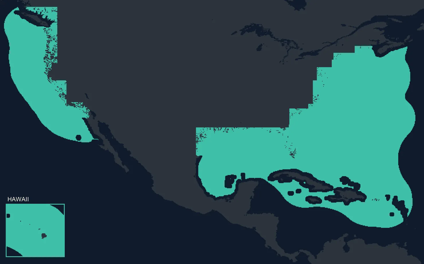
Covered water in green. Drawn from the app’s live coverage map.
Coastal and offshore saltwater of the US East, Gulf and West Coasts, Hawaii, Puerto Rico and the US Virgin Islands, the Bahamas and Bermuda, from the backwater out to the blue water.
Not covered yet: inland lakes, rivers above the tide, and the Great Lakes. Water outside coverage shows grey in the app.
BoatScore is free for every boat. The forecast is the subscription.
Every account starts free, with no card and no trial clock: add your boat, see its score, run the gauge on a ride, read the report. The subscription adds the next 11 days, your spots and alerts, and every Helm page.
Free · no subscription needed
Freeevery boat
BoatScore for every boat
The map, the next 12 hours
Rides, with the live gauge
A report and a shareable card for every trip
The forecast · subscription
11 dayshour by hour
The full 11 days, with wind, waves, swell, tide and current hour by hour
Your spots, with their calmest windows and alerts when a day lines up
Every Helm page during a ride: the forecast comparison, the extra gauge pages and the Ride Rose
The forecast around you stays on your phone when you lose signal
Monthly or yearly. Renews automatically; cancel anytime.
The subscription renews automatically at the price shown until you cancel, which you can do any time in your Apple Account settings. The introductory offer is one per Apple Account; the App Store shows it when you are eligible. If your subscription ends, you keep everything the free plan has: your boats, trips and saved spots stay on your phone, and the alerts you had on come back when you subscribe again.
Why one number
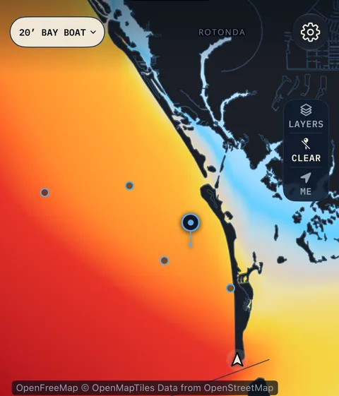
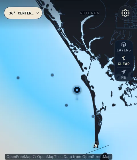
The same afternoon rides differently in a 20-foot bay boat than in a 36-foot center console.
Wind, waves, swell and current become a single score, hour by hour, for your boat. Not a generic sea state: the ride your boat will give you.
One tap on the boat chip re-scores the whole map for the boat you run.
FreeBoatScore, the live gauge, the map for the next 12 hours, a report for every trip
11 daysHour by hour, on the map and at any spot, with a subscription
Your hullScored from your boat's specs, refined by your rides
LiveThe gauge runs during every ride, and every trip gets a report
How it works
Nine screens, one ruler
Swipe through the screens →
ForecastFree: the next 12 hours11 days: subscription
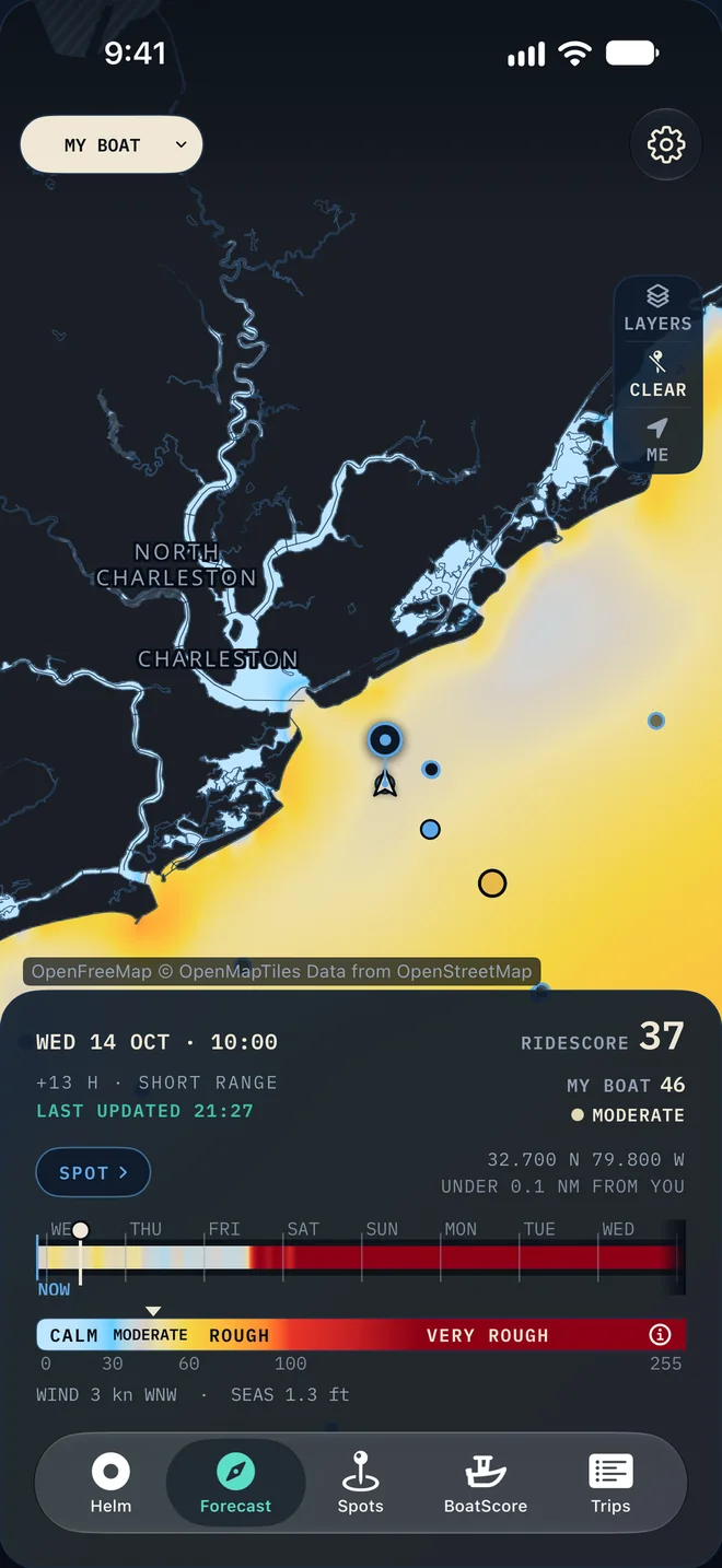
Every hour of the water, scored for your boat
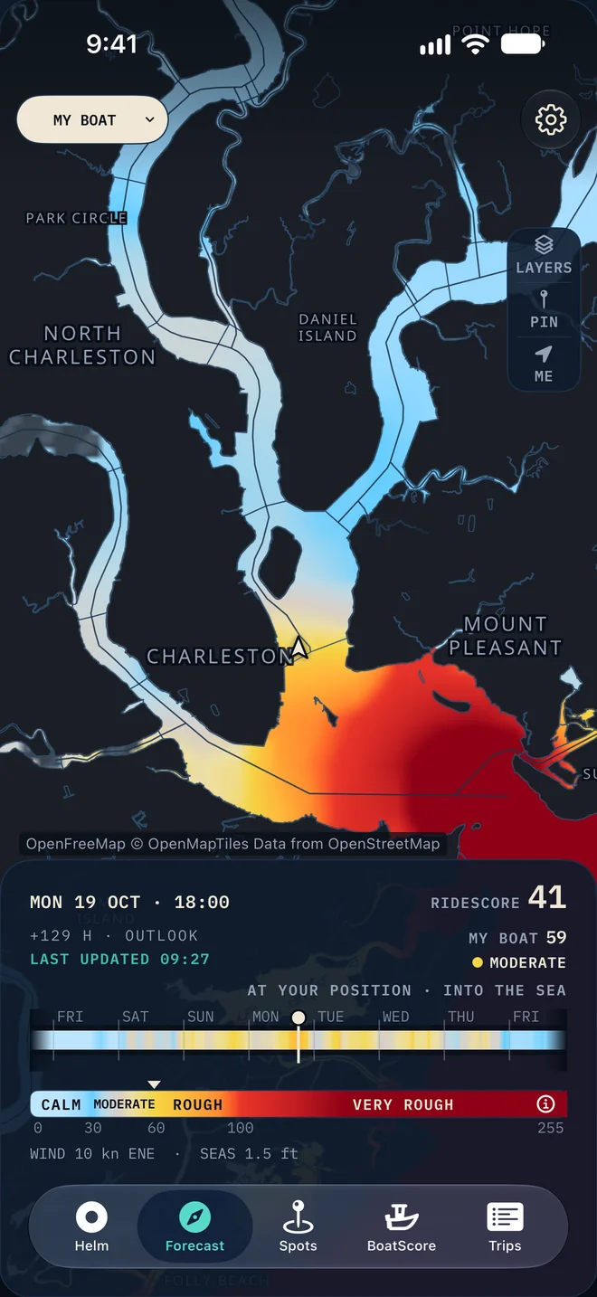
The water gets a number, and so does your boat on it. The next 12 hours are free for every account. With a subscription, drag through 11 days and watch the water change colour for the boat you run.
InshoreFree: the next 12 hours11 days: subscription
From the backwater to the blue water, scored for your boat
Harbors, sounds and rivers are scored on the same ruler as the open ocean, so the run across the harbor and the run to the ledge read the same way.
SpotsSubscription
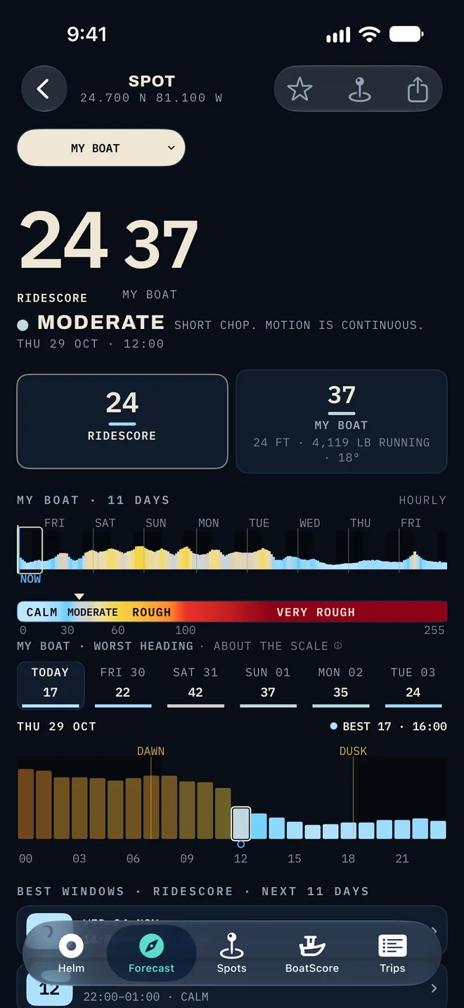
The best hours to run, at the spots you fish
Save your spots and see their calmest windows, day by day
Alerts when a saved spot is forecast to ride the way you set
HelmFree during a ride
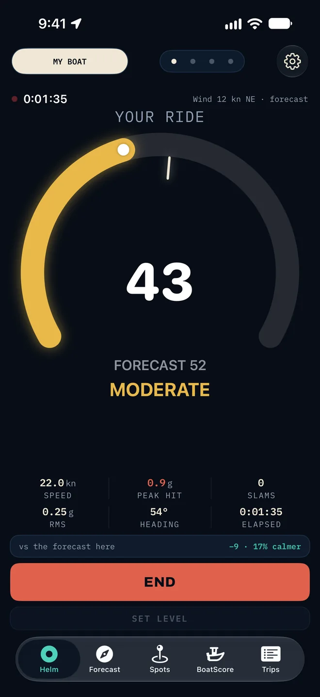
Your ride against the forecast, live
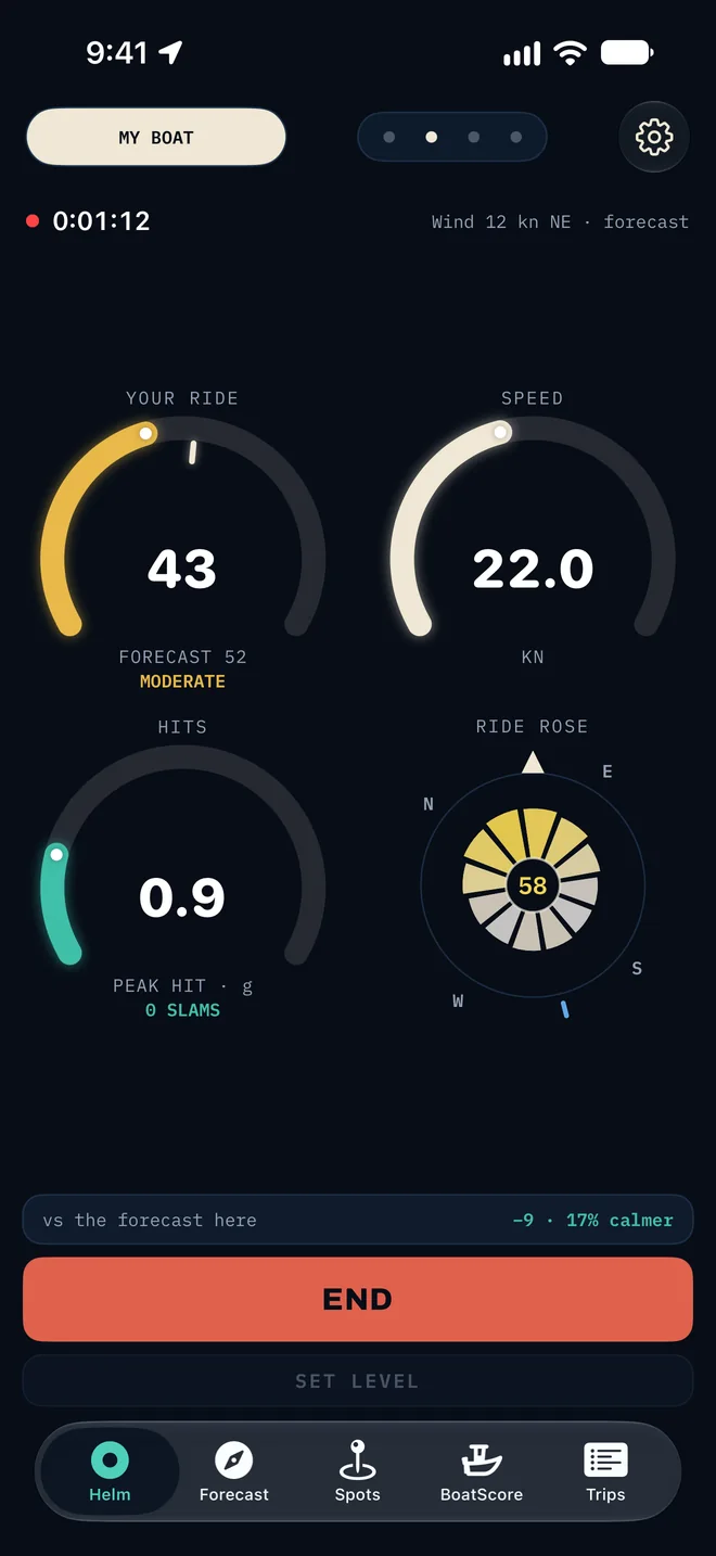
Tap START and the gauge comes alive: the needle is what your boat is doing, the hashmark is what the forecast said. Every account gets the gauge during a ride; a subscription adds the forecast comparison and the extra pages.
HelmSubscription
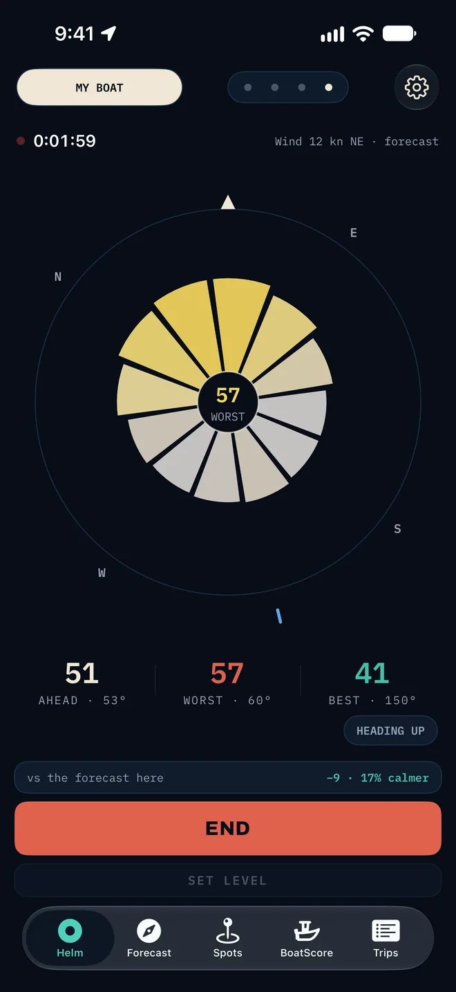
The Ride Rose: how the ride changes with your heading
Every heading, scored. Head seas, beam seas and following seas are not the same ride, and the rose shows which way is smoother before you turn.
HelmSubscription
Your ride on four gauges, live
Your ride, your speed, the hardest hit and the rose on one page, built to be read at a glance with a wet thumb.
ForecastSubscription
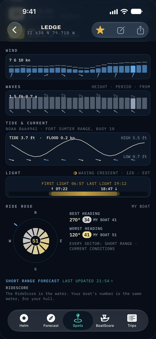
Wind, waves, tide and current, all in one place
Wind and gusts, wave height and period, tide and current, first and last light, in plain numbers. The traditional data is all there, under the score, when you want to see why.
TripsFree
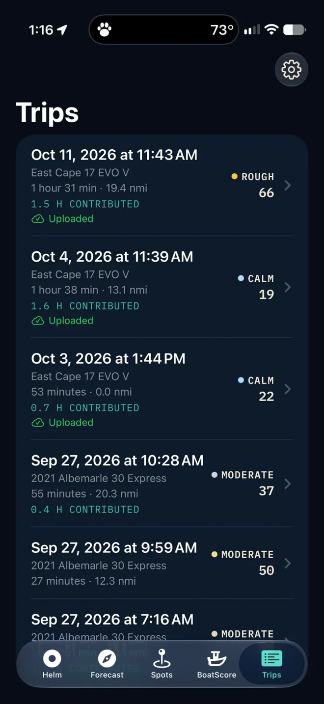
A report for every trip, and a card to share
Every ride, scored, led by its roughest 10 minutes
A card you can share, and a delete that removes our copy too
Your rides are uploaded to improve the forecast
BoatScoreFree
A score built for your hull, sharpened by every ride
Every boat gets a score from its specs, refined by your own rides
RideScore rates the water. BoatScore rates the boat.
Your BoatScore is the roughest water, on the RideScore scale, that this boat can run in before its ride reaches Rough. Higher means a smoother-riding boat. One ruler for the water and the boat, so the two numbers can be read against each other.
Example · a BoatScore of 81
The water RideScore
81
↓ rides like
Your ride in this boat
60
CalmModerateRoughVery Rough
03060100 → 255+
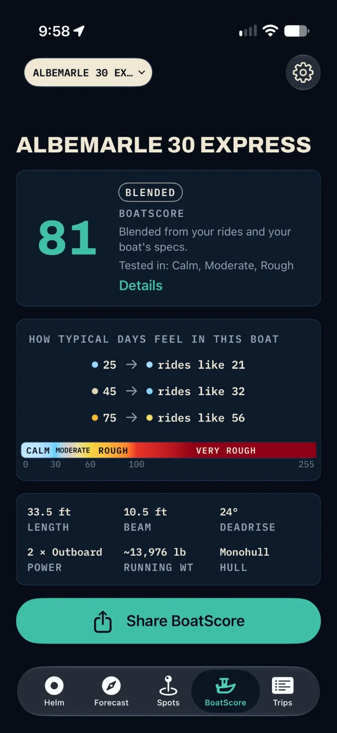
How typical days feel in this boat
The BoatScore page turns the number into days you recognise. For the 81 above, from a real boat:
Water 25
rides like 21
Water 45
rides like 32
Water 75
rides like 56
How the number is measured
Three stages, one number
Modeled
Estimated from your boat's specs the moment you add it: length, beam, deadrise, weight, power and hull. You see it right away, just for you.
Blended
Blended from your rides and your boat's specs, once you have taken a few rides with the gauge running.
Measured
Measured from your rides. It gets more accurate with every ride that counts.
Tested in lists the water your boat has actually been measured in: Calm, Moderate or Rough. Your boat's numbers change only for water you have run in, and RideScore never asks you to go out in rough water.
BoatScore is for powerboats. Every boat you add gets one, free, and each of your boats gets its own forecast. A ride counts toward the score when the phone is on a rigid mount and the boat is on plane long enough to measure.
The scale
One number for how rough it is
RideScore is the water. Your boat is the same water, scored for your hull. Four bands, and anything over 255 shows as 255+.
FreeBoatScore for every boat, the map right now, rides with the live gauge, and a report for every trip. No subscription needed.
SubscriptionThe full 11 days, your spots and alerts, every Helm page. Monthly or yearly. Renews automatically; cancel anytime in your Apple Account settings.
What it is not
Comfort, not safety
RideScore forecasts how comfortable a ride will be. It is about comfort, not safety, and it never tells you whether to go out. It is not a navigation device and does not give routing. Always check the official National Weather Service marine forecast and use your own judgment.